ArcMap Desktop Explorer DPEG Viewer Help Documents

Install Instructions

  1. When downloading the plugins, make sure that they retain their extensions (.esriAddIn for ArcMap Desktop Explorer). If you double click these files, it will prompt you with an installation notice.
  2. Once the ESRI plugin is installed, you must first add it to your toolbar:
  3. Go to the "Customize > Customize mode" menu
  4. Click the "Commands" tab
  5. Look for the "TopoDOT" Category
  6. Drag and drop the "Dpg Image Window" and the "Search Closest Dpg Image" tools to a toolbox of your choice.
  7. ArcMap Pro Toolbar

How to Use

Open Dpeg Button Other methods of loading DPEGs

Open / Load DPEG

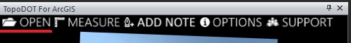
Provides three methods of loading in DPEGs into TopoDOT for ArcGIS. The first option allows you to specify a single DPEG image to load into the tool. The second, center, method allows you to import a DPEG Project File (.dprj) to load into TopoDOT for ArcGIS. The last option allows you to load a DPEG project file from TopoCloud.

Measure Tool

Measure

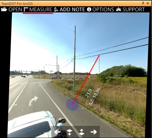
Allows you to make measurements from within the picture perspective in your DPEG. Requires a DPEG first be loaded. Click on Measure and define your starting point within the image by left clicking. The cursor will snap onto the underlying depth data in the image for calculating the spatial origin point. Once the origin point is defined, you should see a red line following your cursor and printing out live measurements from point to point as well as a ΔZ measurement.

Extract Feature

Extract

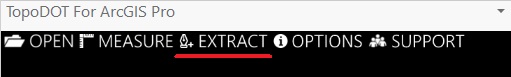
Initialize placement of a feature to add in the "Create Feature" toolbox. Then press the Extract button to allow you to click directly on the image depth data to place vertices / points in ArcGIS.

Extract Feature

Options

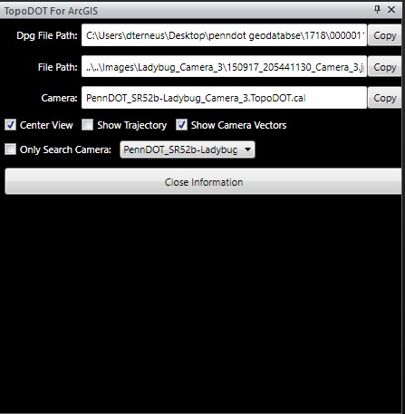
Allows you to copy the filepaths for the DPG file, image file, or the camera calibration file.

Other options:

  • Center View: Centers the image within your TopoDOT for ArcGIS window on load.
  • Show Trajectory: Shows the trajectory line that the images were taken along.
  • Show Camera Vectors: Shows the camera's perspective vectors drawn in your ArcGIS environment.
  • Only Search Camera: Allows you to lock your project to a single camera perspective when searching for closest image to point.

The lowest risk, highest return investment you can make in your productivity!

Contact Us Pricing